Darwin International Airport (DRW)
City Orientation and Maps
(Darwin, Northern Territory (NT), Australia)
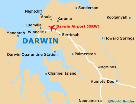
The city of Darwin can be found on the northern side of Australia and is the territorial capital of the Northern Territory. Located along the coastline, Darwin enjoys a small peninsula setting and lies directly east of both Waugite and Mandorah, across the water.
The very centre of Darwin is quite compact and is sited towards the end of the peninsula. Smith Street Mall is where you will find the majority of shops in the Darwin area and is located a short distance to the south-east of Daly Street, which ultimately leads to the Stuart Highway, a major road that loops much of the city and connects Darwin Airport (DRW), to the north-east.
Darwin Airport (DRW) Maps: Important City Districts
Many areas and neighbourhoods within Darwin stand out, such as Woolner and Winnelie, which are both located directly north of the city centre. Further north you will find the East Point Reserve, which covers an enormous area and is home to numerous walking trails and cycle tracks, together with mangrove forests and the beautiful Lake Alexander.
Other areas of interest in the Darwin area include Cullen Bay Marina, which is close to the centre and enjoys a selection of shops, harbour cruises, a boardwalk and numerous eateries, serving freshly caught seafood. Located a mere 2 km / 1 mile to the north-west of Darwin city centre are the Darwin Botanic Gardens, featuring an impressive collection of tropical plants, areas of rain forest, large palms, water features and a popular Aboriginal plant trail.
Australia Map

Darwin Map